The biggest obstacle to a first adventure motorcycle trip isn’t the route, but analysis paralysis. San Cayetano, a municipality 98 kilometers north of Bogotá, is usually reached from Cogua by crossing stretches of páramo and unpaved roads. However, to step out of my comfort zone without getting overwhelmed, I decided to take a different alternative: entering through the “La Empalizada” rural road, starting from the Zipaquirá - Pacho highway, and then joining the main road.
At first, the idea of leaving the asphalt seemed like a monumental challenge for a beginner. But being at the controls of a Honda XR190L changed the equation; its lightness and agility proved to be the best attributes for this type of terrain. In this post, I break down each stage of this route, designed to build confidence.
Leaving the Asphalt: The Detour in Zipaquirá
The starting point is Zipaquirá. After about 20 minutes of riding through light traffic on asphalt towards Pacho, you need to watch out for the entrance to the “La Empalizada” road. This detour appears just before reaching the Alto de la Virgen. If you see the Virgin monument on the side of the road, it means you’ve gone too far and need to turn back.
La Empalizada Road: Traction and Confidence
“La Empalizada” is a dirt country road that connects several farms in the area. It has some sections of placa huella (concrete wheel tracks), but it lacks steep drops or obstacles that would force the bike or challenge a rider with limited experience.
The terrain was dry, offering predictable traction that served as the perfect warm-up. It’s the kind of road that allows you to relax your shoulders, understand how the suspension responds, and mentally prepare for what’s next, without the pressure of fast-moving traffic.
Ascent to the Páramo: Riding Above the Clouds
The traditional route from Cogua borders the Neusa reservoir, but by entering through La Empalizada, you intercept the main road much further ahead, skipping that section. What you lose in reservoir views, you gain in a direct immersion into the mountains.
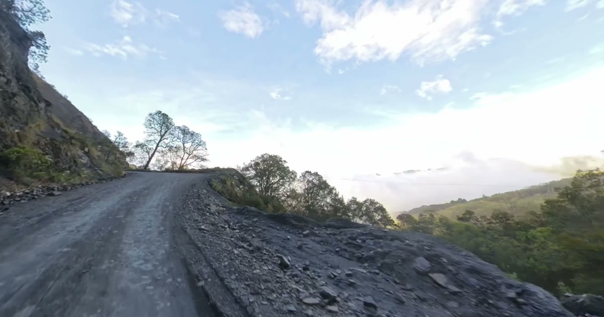
This main stretch offers the greatest scenic variety of the trip. A few minutes after joining it, the temperature drops and the classic páramo ecosystem surrounds you. After passing an area adorned with small high-altitude lagoons, the visual reward is absolute.
After a mandatory stop to rest the body, I continued the ascent. The altitude transforms the geography to the point where the road seems suspended in the sky. At the highest points of this corridor, you literally find yourself riding above the cloud line.
The Final Stretch: New Asphalt and La Peña
As the landscape changed, I came across a pleasant surprise: a stretch of flawless asphalt. For a moment I thought I was already at the entrance to San Cayetano, but there were still several kilometers to go. This paved section corresponds to recent road improvement works, specifically between the Mortiño and Cardonal rural districts.
When the pavement ends, the road alternates again between dirt and placa huella, but the environment becomes dramatic. You pass through an area dominated by a spectacular rock formation known as “La Peña” (The Crag). Its imposing presence is the definitive geographical indicator that the final destination is just around the corner.
The “New” San Cayetano and the Next Destination
Shortly after leaving La Peña behind, you finally arrive in San Cayetano. It is a small, quiet town that welcomed me with the everyday scene of a soccer match on the municipality’s main field.
This adventure led me to discover that this settlement is, in fact, the “New” San Cayetano. Due to geological instability, the inhabitants of the original town (located further down in a warmer climate) were forced to relocate here.
Completing this route proved that you don’t need a heavy motorcycle or years of experience to enjoy off-road riding. The transitions between placa huella, dry dirt, and asphalt make this route the ideal laboratory to practice maneuvers and lose the fear of leaving the city. The XR190L’s engine handled the altitude without breaking a sweat.
If you want to see the full route and how the bike handled each section, visit my YouTube channel [Link], where the Insta360 captured every detail of the trip. If you are starting out and want to join exploratory rides like this, reach out to me. My next expedition went there: read the chronicle of San Cayetano Viejo.
Useful Resources: